Consequences of blowing up the Kakhovskaya HPP for the ecosystems of southern Ukraine
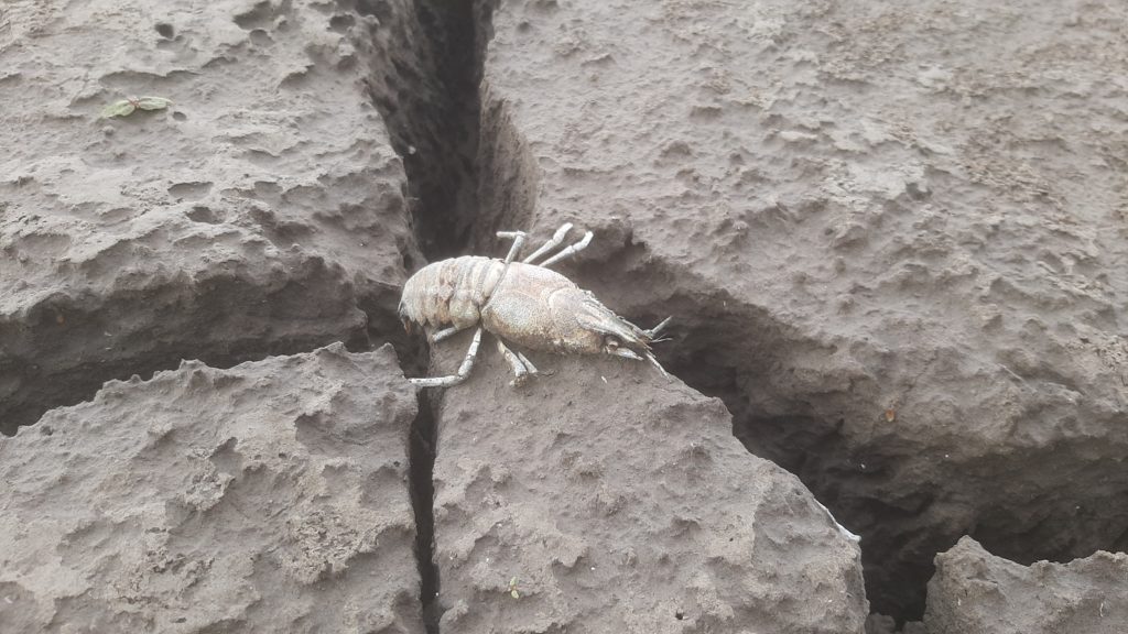
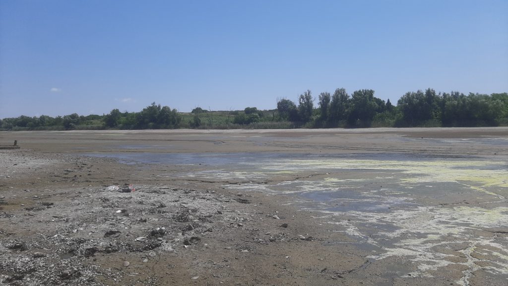
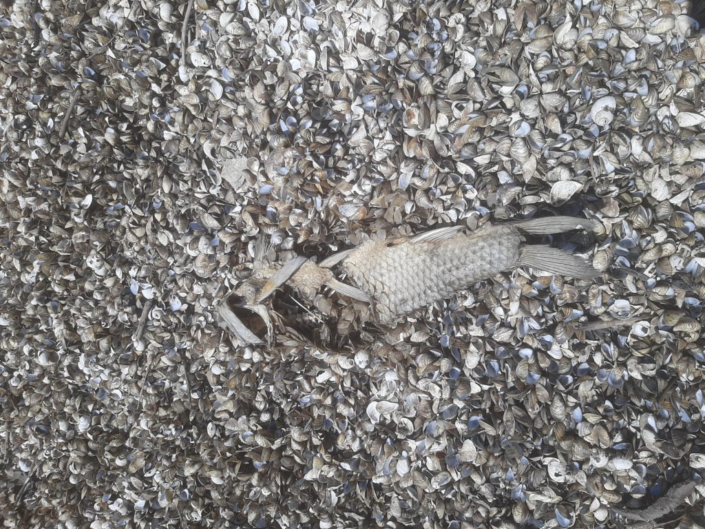
Walking along the bottom of the former reservoir, we saw thousands of shells from dead molluscs. They were scattered everywhere, among them lay the dried skeletons of crayfish, and sometimes there were remains of fish. Frogs croaked in the remaining lakes, surely, they would die soon, because their pool was mercilessly shrinking every day. And in the mud, you can clearly see the footprints of a bog turtle, where will it live now? Where will she find a new home? How much will she have to crawl to get to the water again?
In July, the EPL team, together with scientists from the Institute of Botany of the National Academy of Sciences of Ukraine and Kherson State University, took part in an expedition to the Kherson region to the shores of the former Kakhovsky Reservoir and its inlets on the territory of the Kamianska Sich National Nature Park. Together with the employees of the park, Mylivska Bay and Kamyanskaya Balka were surveyed.
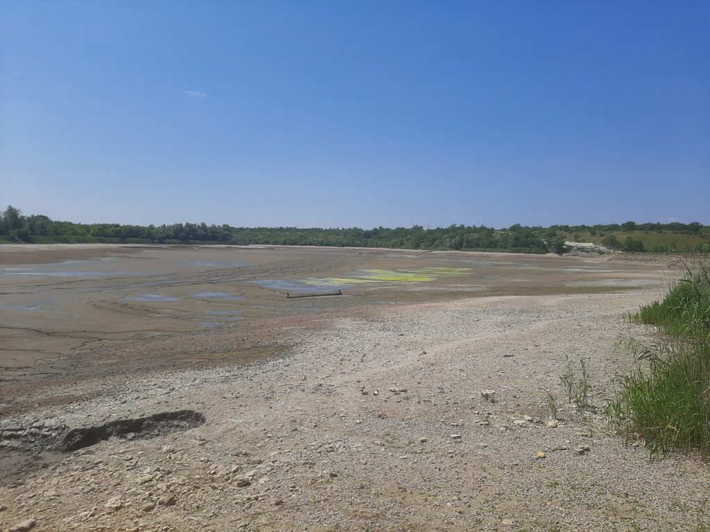
The bottom of the former reservoir was exposed, revealing the mosaic structure of the Dnipro river and numerous lakes in place of depressions. The other shore is located 7 kilometers away and is still occupied by Russian troops. A red flag indicates the presence of explosive objects. Unfortunately, 30% of our country is now contaminated with mines, unexploded shells, grenade strings and other dangerous things. We manage to take silt samples and see the beginning of the bottom being overgrown with plants and decide to move to another location.
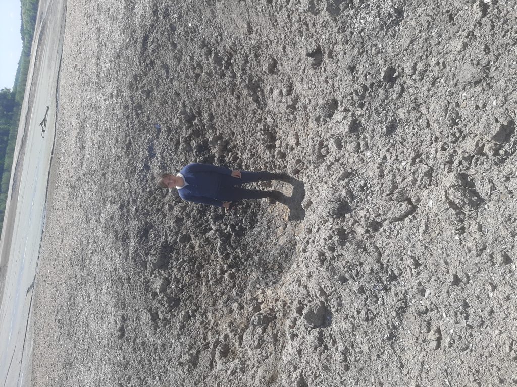
Mylivska Bay was a part of the Kakhovsky Reservoir. “I calmly walk along the bottom for 300 meters, jump over a stream and approach a fresh shell crater. It exploded recently, already after the disaster at the HPP. The earth is scattered around, the walls of the crater are covered with a black coating from burning. I collect small pieces of shrapnel. I am taking soil samples” – EPL ecologist Kateryna Polianska shares her impressions, – “We send samples to laboratories in Ukraine and Switzerland. Preliminary results from the laboratory in Bern from the territory of the park showed an excess of the maximum permissible concentration of heavy metals in one of the craters, copper by 25 times, zinc by 48 times, lead by 2 times, nickel by almost 6 times.” In the upper part of the bay, a larger amount of water has been preserved due to the presence of a dam, and a stream flows along the bottom of the bay, which in the past was probably the main watercourse in this area. We see 6 more craters, as well as part of the projectile.
The water level in Kamianska Balka fell by more than 10 meters. Its bottom looks like the surface of a new unexplored planet. Although this is only the Kamyanka River, which has not seen its true banks and light for almost 70 years. There are even buried floodplains left here, and tree branches stuck out from the bottom, plastered with mollusk shells and numerous fishing nets, an old wooden boat lies nearby, and a whole boat is moored around the corner. The river has a shallow depth, the fish is trying to escape through it, unfortunately we cannot help it, it is not possible to approach the channel due to a large amount of silt with water, which instantly sucks and does not allow movement. A little further away we see a water snake, it also moves after water. As in the Myliv Bay, the shores and bottom of the creek are covered with numerous shells, crayfish skeletons lie among the cracked, dried mud, and sprouts of the first grass make their way nearby.
The water left these areas. What changes will take place in landscapes, how will the processes of self-renewal of nature proceed? Will there be enough surrounding plowed areas to feed small rivers and streams, what will be the new level of groundwater, the microclimate of the area, or will floodplain forests die? What will be the first plant species on the former floor, native or invasive? Which scenario of restoration of this territory will be correct?
Kateryna Polianska, EPL ecologist

